
BOZEMAN – Moderate to heavy rain is impacting SW Montana Friday afternoon and that trend will continue into Friday night. The current weather pattern is a slow-moving Low-pressure system that will continue to produce wrap around bands of moisture.
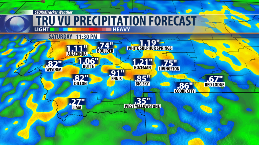
Look for an additional quarter of an inch to one inch of rain Friday night into Saturday.
The atmosphere will be cooling at all levels overnight and that means snow levels will be lowering down to mountain pass level by morning and into Saturday. In fact, I would not be surprised if the lower valleys pick up some slushy snow accumulations on grassy surfaces Saturday.

This first storm system will be exiting our region by Sunday morning with a brief break between storms by Sunday afternoon. Several other Pacific storms will be rolling into Montana beginning Monday. A long duration cool and wet weather pattern is likely for most of next week.
City by City Forecast:
BOZEMAN: LOW: 37°; HIGH SATURDAY: 49°. Rain likely Friday night with gusty winds, watch for fog overnight. Snow levels 7,000′ and 2″ – 5″ of snow is possible. Rain could mix with snow early Saturday morning in Bozeman and minor accumulations on grassy surfaces. Saturday snow levels lower to 6,000′ with an additional 3″ or more possible. Bozeman will see scattered rain or snow Saturday.
BUTTE: LOW: 35°; HIGH SATURDAY: 52°. Rain or snow is likely Friday night. Snow is possible by early Saturday morning in Butte with minor accumulations. Saturday look for patchy valley fog, scattered rain or snow mostly in the morning and breezy.
DILLON: LOW: 36°; HIGH SATURDAY: 54°. Rain likely Friday evening with snow above 7,000′. Patchy valley fog is possible by Saturday morning. Scattered rain or snow is likely Saturday morning and a few showers by Saturday afternoon. Gusty winds at times.
WEST YELLOWSTONE: LOW: 30°; HIGH SATURDAY: 48°. Colder Friday night into Saturday. Rain or snow is likely with snow accumulations above 6,000′. Patchy valley fog is possible. Gusty winds at times.
