
BOZEMAN – The atmosphere is very unstable again today across Montana especially east of the divide. Building thunderstorms will be increasing in strength and coverage around 5 pm locally. Some storms could produce very heavy rainfall, small to large hail, strong outflow winds, and frequent and deadly lightning.
Most storms will weaken around sunset. Overnight a Low will spin through the region continuing to produce cool, wet and windy weather into Tuesday morning. By Wednesday a brief break in the weather but the next weather maker will push clouds back into the region by Wednesday afternoon.
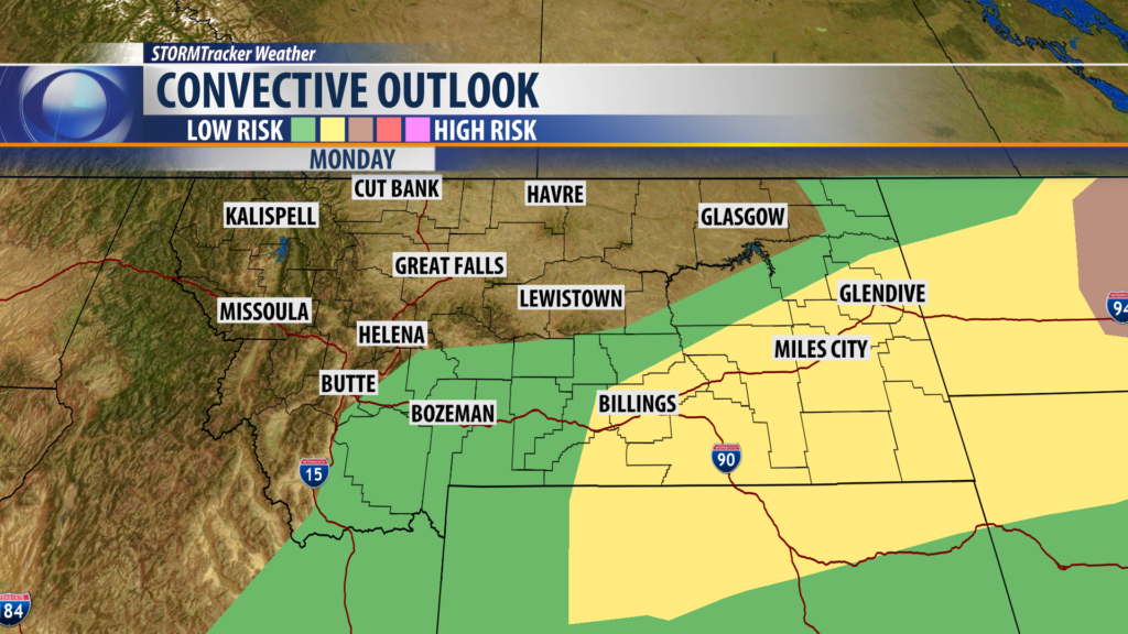
Storm Prediction Center has a “marginal” low risk for strong to severe thunderstorms in SW Montana east of the divide but a higher risk for damaging storms from Billings to Glendive southward this afternoon and evening. Over the last 4 days slow moving storms have produced incredible rainfall leading to areas of flash flooding.
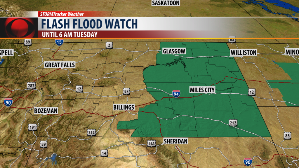
FLASH FLOOD WATCH:
The National Weather Service has a FLASH FLOOD WATCH up for eastern Montana now through 6 am Tuesday. Strong to severe thunderstorms could produce very heavy rainfall which could produce flooding issues overnight.
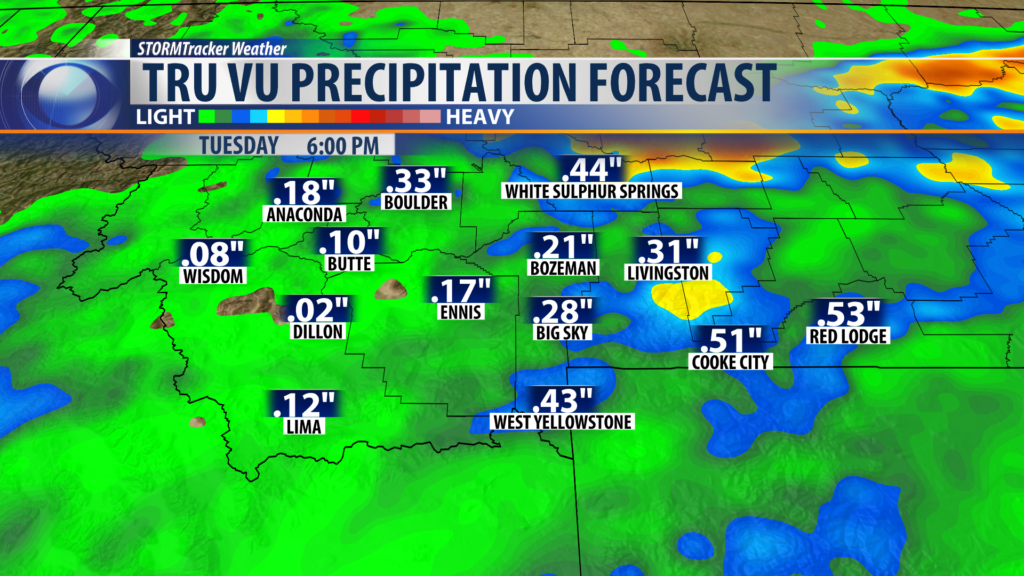
City by City Forecast:
BOZEMAN: LOW: 47°; HIGH TUESDAY: 73°. Showers and thunderstorms are likely again this afternoon and evening for Bozeman. Some could be strong to severe. Look for brief heavy rain, small hail, strong winds, and frequent lightning. Most storms should be ending around sunset but there is a slight chance for a few storms overnight into Tuesday morning.
BUTTE: LOW: 43°; HIGH TUESDAY: 73°. Scattered showers and a few thunderstorms are possible over Butte Monday afternoon and evening. Most storms should diminish by sunset. Tuesday look for cooler temperatures and gusty winds with a few isolated showers or thunderstorms.
DILLON: LOW: 44°; HIGH TUESDAY: 74°. Showers and thunderstorms are rolling up into Beaverhead County again this afternoon and evening. A few thunderstorms could be strong to severe but most storms will diminish around sunset. Tuesday look for a few isolated showers or thunderstorms.
WEST YELLOWSTONE: LOW: 37°; HIGH TUESDAY: 70°. Showers and thunderstorms are building near West Yellowstone Monday afternoon. Stronger thunderstorms are possible by late afternoon. Most storms should diminish by sunset but even overnight a few showers and isolated weak thunderstorms are possible into Tuesday morning.
