
BOZEMAN – Temperatures are running around 10 degrees warmer today compared to Monday and as of 1 pm a few cities in SW Montana have reached 90 degrees. Why? A cold front is beginning to move into the Pacific NW and ahead of this front a stronger SW flow aloft is helping to usher in stronger surface heating.
The aforementioned cold front will hit the state Wednesday and produce gusty surface winds with very little to no rainfall. Fire danger will be higher with this mostly dry cold front on Wednesday. Temperatures will begin to drop behind this cold front with highs reaching the comfortable low to mid-80s beginning Thursday.
FIRE WEATHER WATCH
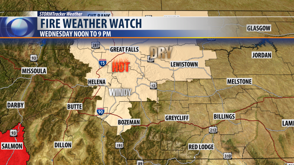
A Fire Weather Watch is up for Wednesday afternoon and evening for Central Montana but this does include a few counties in SW Montana as well.
The entire state will see higher fire danger Wednesday with a dry cold front producing surface winds 20 to 50 mph at times, humidity levels below 20% and temperatures in the 80s to lower 90s. All of these factors will increase fire danger across Montana. Please use common sense and be extremely careful with all outdoor activities Wednesday as a small fire could quickly turn into an out of controlled fire with the forecasted conditions.
City by City Forecast:
BOZEMAN: LOW: 57°; HIGH WEDNESDAY: 87°. Hot this afternoon with building storm clouds and a few afternoon to early evening thunderstorms. Partly cloudy overnight and mostly sunny Wednesday. Look for gusty winds Wednesday afternoon as a dry cold front passes through the state.
BUTTE: LOW: 54°; HIGH WEDNESDAY: 84°. Hot in Butte this afternoon with increasing clouds and a few late-day thunderstorms. Wednesday should be mostly dry and a little cooler as a cold front passes through the state but stronger afternoon surface winds are likely for Butte.
DILLON: LOW: 54°; HIGH WEDNESDAY: 86°. Thunderstorms are possible for Dillon and Beaverhead County this afternoon and early evening. Wednesday will be slightly cooler as a cold front passes through producing mostly gusty winds.
WEST YELLOWSTONE: LOW: 48°; HIGH WEDNESDAY: 82°. A few thunderstorms are possible Tuesday afternoon and evening and again Wednesday afternoon and evening.
