


BOZEMAN – Another week of extreme heat, abnormally dry conditions, and thick wildfire smoke.
Temperatures are expected to jump into the lower to upper 90s this week especially for through Thursday.
A cold front will bring some relief to the region from the extreme heat by the end of the week and upcoming weekend with forecast highs falling into the 70s to lower 80s.
That cold front will bring increasing surface wind gusts Thursday and the combination of hot, dry and windy conditions has a FIRE WEATHER WATCH Thursday through Thursday early evening.
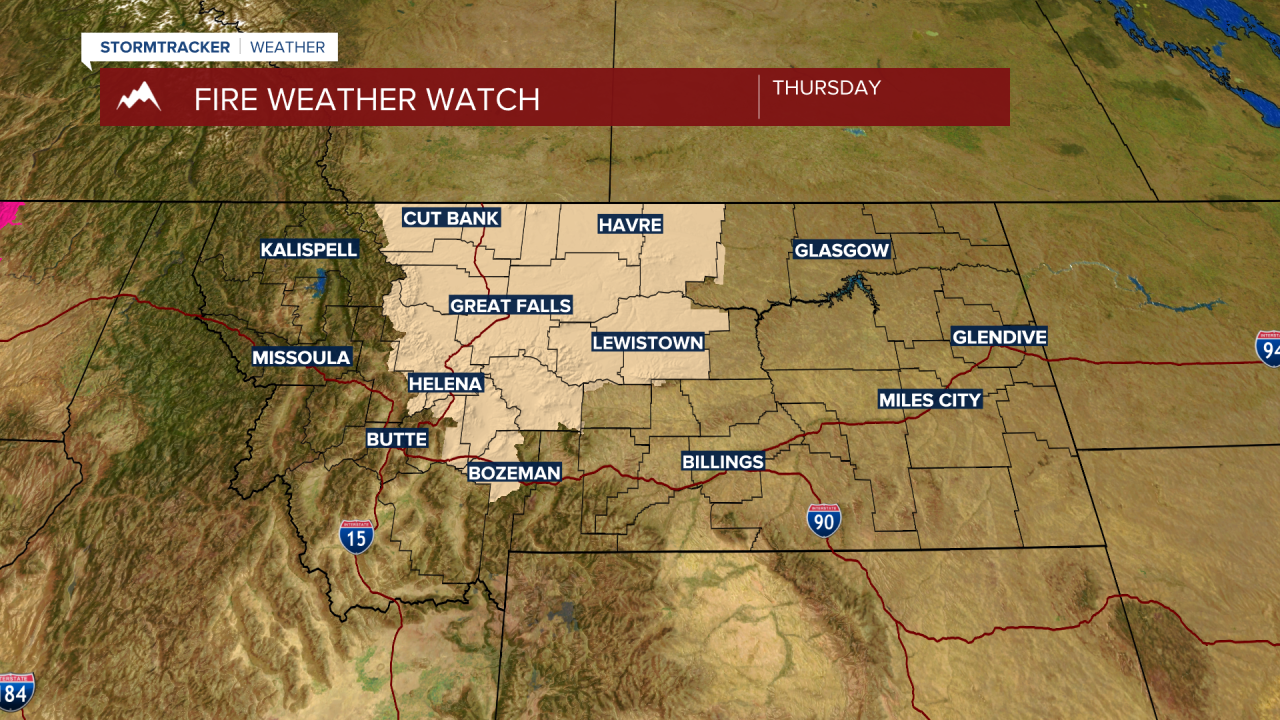
The area of greatest concern is across Central Montana dipping down into the Bozeman area Thursday afternoon. Wind gusts over 30 mph are possible with this front passage.
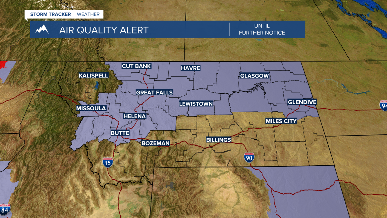
An AIR QUALITY ALERT is up across most of Montana until further notice. Particulate levels have been rising with thick wildfire smoke covering most of Montana and from Butte to Glasgow smoke levels are high enough to cause health problems for those sensitive to thick smoke.
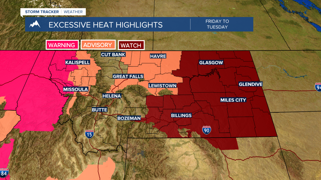
Lastly, extreme heat is gripping most of Montana and excessive heat highlights are ongoing across Western Montana through Tuesday afternoon with triple digits highs from Missoula to Kalispell.
That extreme heat will begin to move into Eastern Montana Wednesday and Thursday. An Excessive Heat Watch has been issued for Wednesday afternoon into Friday. Forecast highs will be in the upper 90s to lower 100s.
Monsoonal thunderstorms are possible locally for the next several days. Thunderstorms should be more on the isolated side but dry thunderstorms are the greatest concern with Lightning and little to no rain.
