


BOZEMAN – Another Arctic front is coming, and it will produce widespread snow, blowing and drifting snow, and extremely cold air temperatures along with bitterly cold wind chills.
The Arctic front should reach northern Montana Tuesday afternoon or evening and fall into southern Montana by Wednesday morning.
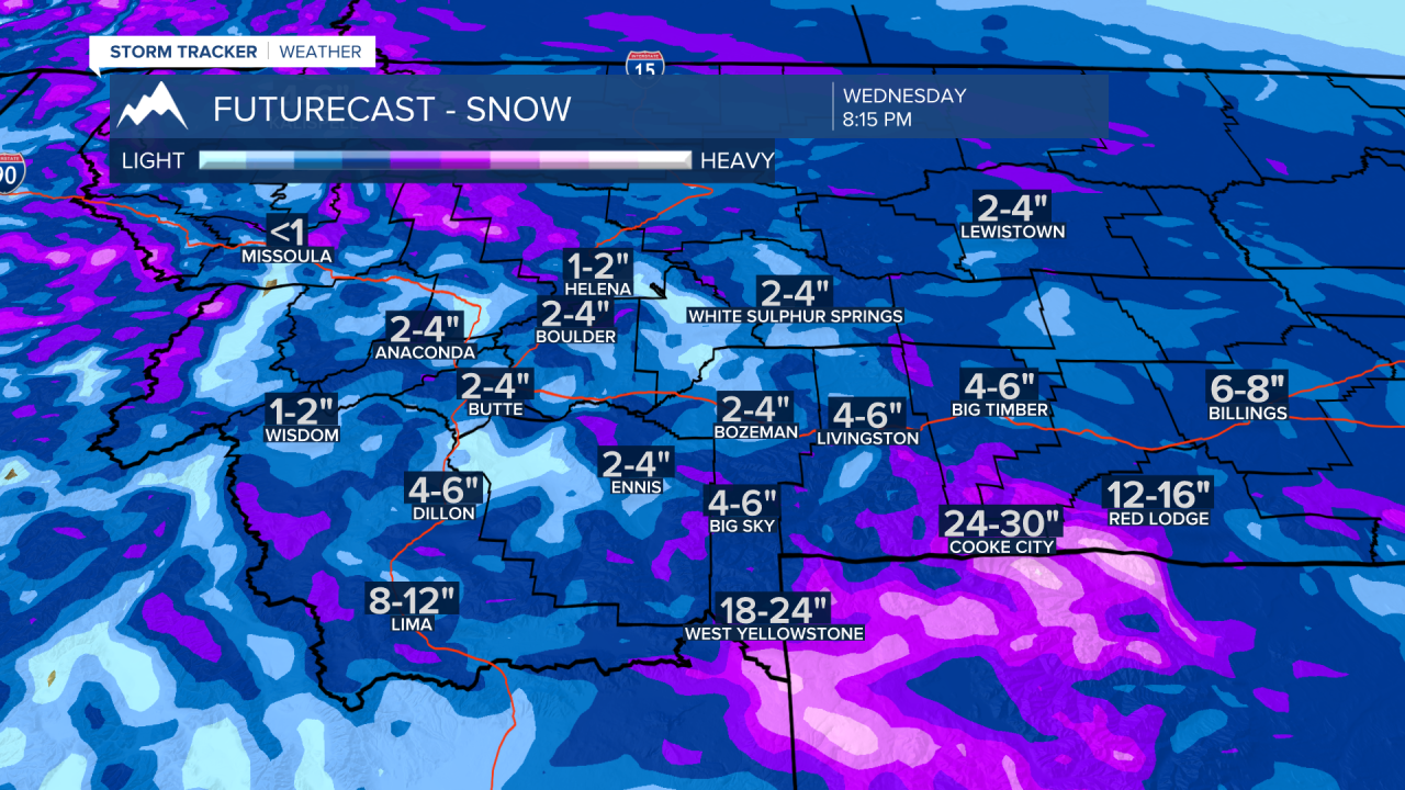
There is a healthy stream of warm moist Pacific air passing through Montana right now with mountain ranges across the state picking up accumulating snow.
As the Arctic front clashes with this warm moist Pacific air look widespread snow at all levels Tuesday into Wednesday morning.
Higher mountain ranges could see several feet of snow and valleys locally should see 2”-5”.
The other travel hazard is associated with stronger surface wind gusts around 50 to 60 mph. That will produce considerable areas of blowing snow, drifting snow, and very poor visibility.
The snow and wind should begin to diminish Wednesday evening and with clearing skies temperatures will likely fall between –10 to –20 below zero Thursday morning. Wind chills could be colder than –30 below zero.

Here are the winter weather highlights across Montana.
The National Weather Service has issued a WINTER STORM WARNING from midnight Monday through 11 pm Wednesday.
Mountains could see 1’ to 2’ feet of snow. Lower valleys could see 6”-12” of snow. Wind gusts to 55 mph will produce blowing and drifting and extremely cold wind chill values.

The National Weather Service issued a WINTER WEATHER ADVISORY for SW Montana east of the divide from midnight Monday to 5 am Wednesday.
Valleys could see 2”-5” of snow including Bozeman. Mountains could see up to 10” or more and wind gusts to 55 mph will produce blowing and drifting snow with low visibility.

The National Weather Service continues a WINTER STORM WATCH west of the divide for the Butte-Blackfoot region. This will likely get upgraded with warning or an advisory later today.
General snow accumulations of 6”-12” is possible along with wind gusts to 55 mph.
