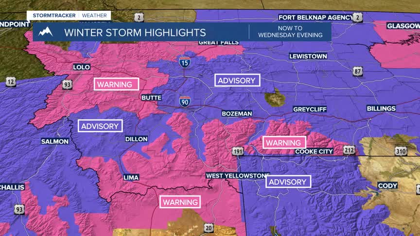


BOZEMAN – A slow moving upper-level trough and deep area of Low-pressure continues to track to the east and continues to produce snow and blowing snow over Idaho, Wyoming, and Montana.

Winter Storm Warnings and Winter Weather Advisories are in effect through this evening with most expiring by midnight.
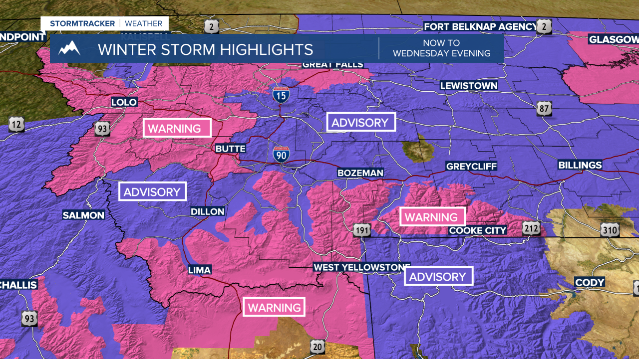
Wrap around snow along localized gusty winds will produce difficult to hazardous travel conditions through this evening and possibly through Thursday morning.
Another 1”-4” of snow is possible at lower elevations with 2”-6” at higher elevations through this evening.

This cold powdery snow is easily picked up with gusty surface winds and traveling vehicles creating low visibility issues through this evening.
Accidents between Butte and Missoula created severe driving problems Wednesday late morning.
This storm should exit the region by Thursday. As skies clear, abundant ground snow, temperatures will fall down around zero and possibly below zero for some Thursday morning. The coldest morning lows are likely to be Friday morning and Saturday morning.
