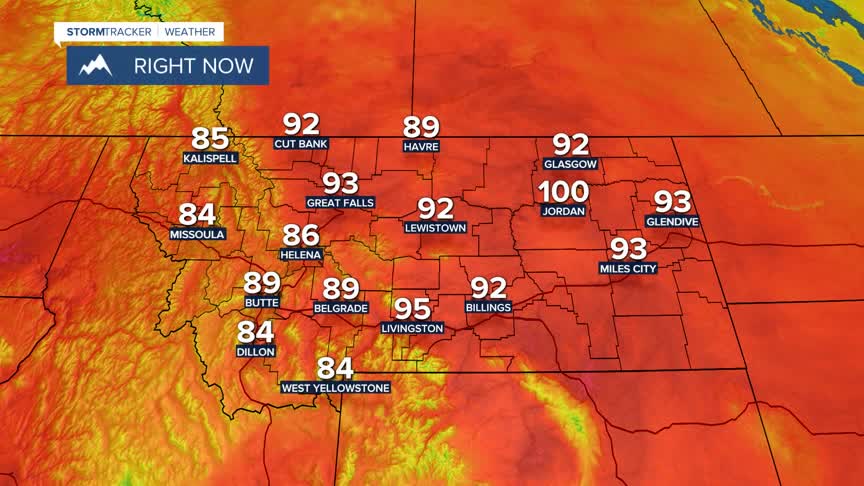


BOZEMAN – Extreme heat is impacting Montana Monday afternoon. Forecast highs are in the 90s to low 100s both east and west of the divide.
Record highs are possible locally for SW Montana today, I’ll update the official highs for the day tonight at 5:30 pm and 10 pm on KXLF and KBZK.
Other complications surrounding the extreme heat is a mix of heat advisories and red flag warnings. Both are outside of our region but do cover large areas of Montana today into tonight.
A plume of monsoon moisture is following the jet stream and is currently over Northern California. The flow aloft will send this moisture into central Idaho tonight and SW Montana Tuesday afternoon through Wednesday afternoon.
Thunderstorms are possible and some could be strong to severe Tuesday afternoon and evening. The Storm Prediction Center has a “marginal” or low risk a few thunderstorms could produce damaging wind gusts or large damaging hail.
Forecast models today (could change) shows the southern half of Beaverhead, Madison, and Gallatin counties will likely see the best chance for thunderstorms Tuesday afternoon. However, Tuesday night into early Wednesday morning additional thunderstorms are likely to pass through Butte and Bozeman.
The hot and dry conditions combined with thunderstorm activity could produce new wildfire starts this week.
