


BOZEMAN – A strong cold front produced numerous strong to severe thunderstorms over SW Montana Tuesday evening with damaging wind gusts as the primary threat.
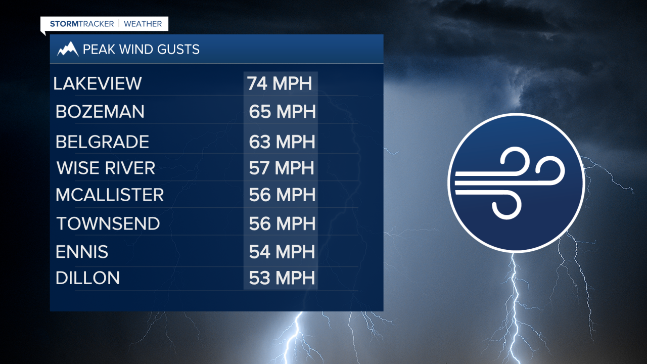
Local storm reports from the National Weather Service had peak gusts between 53 mph up to 74 mph Tuesday evening. Numerous reports of tree damage and property damage from the storms.
A Low-pressure system is spinning over NW Montana today producing rain and isolated thunderstorms. From Missoula to Kalispell will have the higher probability for steady rainfall today into this evening.
SW Montana will remain on the bottom end of this Low-pressure system and there could be a few scattered showers and thunderstorms Wednesday afternoon and evening especially north of I-90.
The biggest weather hazard today will be strong surface wind gusts and in high wind areas peak gusts over 50 mph are possible Wednesday afternoon and evening.
The current storm in NW Montana will slowly spin up into Canada and the overall weather pattern will settle down Thursday into Friday with a slight chance for a pop-up thunderstorm.
The next weather maker will arrive on Sunday and another round of showers, thunderstorms and gusty winds are likely especially by Labor Day.
