


BOZEMAN – An active weather pattern has started today with a weak disturbance producing mostly mountain snow is pushing through SW Montana into Sunday morning. Mountain passes could see several inches of snow and localized areas of blowing snow.
NW flow aloft will pave the way for abundant Pacific moisture to roll over Montana Monday through Wednesday morning. Snow will be heavy at times especially over mountains and passes. Valleys could see short bursts of heavy snow with steady light snow Monday through Wednesday. Over the next 5 days valleys could see a total snowfall around 4”-8”, mountain passes could see up to or over a foot of snow, and above pass level look for 1’ to 3’ feet of snow.
This will be a warm moist flow and there could be some lower valley rain mixing with snow. The problem with the higher water content in the snow is Arctic air will dive rapidly into Montana beginning Tuesday night. The rapid temperature drop will produce flash freezing of wet, slush covered roads, producing extremely icy road surfaces.

The Arctic front will also produce gusty surface winds. That means areas of blowing snow is possible as the heavy wet snow turns into a dry powdery snow by Tuesday evening. Gusty winds will produce bitterly cold wind chill values Wednesday into Thursday and possibly colder than –30 below zero at times.
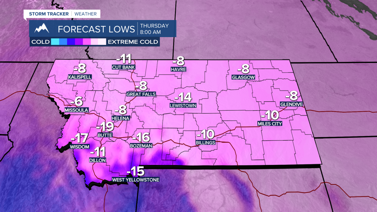
The snow will be ending Wednesday and the extreme cold will begin Wednesday and last through Friday. The coldest morning lows will likely by on Thursday and locally –10 to –25 below zero air temperatures with wind chills colder than –30 below zero.
By next weekend temperatures will begin to moderate and hopefully rise to at least seasonal levels in the 30s.
