


BOZEMAN – More high impact weather to move across Montana for the rest of the week.
First Flood Watches and Flood Advisories continue through Wednesday afternoon as low elevations snowmelt is producing minor flooding with the current above normal temperatures.
Next, high winds also continue into this evening ahead of a cold front. High Wind Warnings and Wind Advisories are up through midnight for most of SW Montana and peak wind gusts 50 to 70 mph are possible. Wind in general should diminish overnight into Wednesday.

Next is a slower moving Low-pressure system right over SW Montana developing Wednesday evening and lingering through Friday morning.
This will bring another heavy wet snow event especially for mountains and passes around SW Montana.
The National Weather Service has issued WINTER STORM WARNINGS for mountain ranges east of the divide in SW Montana. Most ranges could see 6”-12” or more but the Tobacco Root range could 1 to 2 feet of snow Wednesday night through Friday morning.

The National Weather Service has issued a WINTER WEATHER ADVISORY for valleys east of the divide including Bozeman Wednesday evening through Thursday evening. 3”-6” of snow is possible but some forecast models are showing much higher amounts are possible.
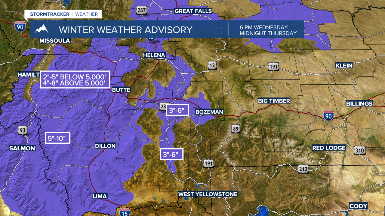
West of the divide valley and mountain snow is likely with 2”-5” below 5,000’ and 4”-8” above 5,000’ is possible and this will impact travel conditions.
By Friday afternoon this storm will exit the region and another rapid warm up is expected by the weekend. This could once again bring rapid snowmelt and cause some minor low land flooding issues by Sunday or into next Monday.
