

BOZEMAN – Another high wind event setting up to impact Montana Friday afternoon through Saturday afternoon.
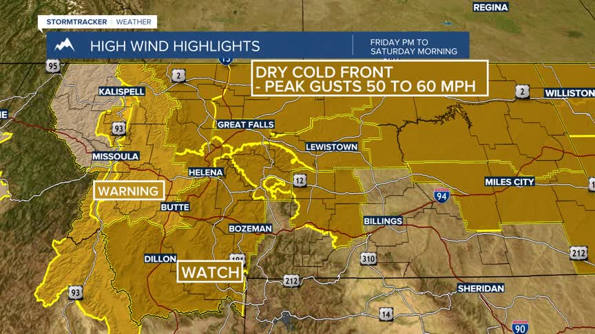
A mostly dry cold front will pass through Montana late Friday into Saturday, a powerful Polar Jet Stream will contribute to strong and possibly damaging peak wind gusts late Friday into Saturday.
The National Weather Service has HIGH WIND WARNINGS up for SW Montana west of the divide Friday afternoon into Friday evening. This includes the Butte-Anaconda-Deer Lodge areas and the Blackfoot region.
The National Weather Service has issued a HIGH WIND WATCH for SW Montana east of the divide Friday afternoon into Saturday morning. Conditions look favorable for possible peak wind gusts up to 60 mph especially in high wind areas. This watch will likely see an upgrade to a warning soon.
The other issue with wind and a dry cold front will be increasing critical fire weather conditions Friday into Saturday.
There are Red Flag Warnings and Fire Weather Watches up across all of SW Montana Friday afternoon into Saturday with the triple threat of high winds, above normal temperatures ahead of the front, and low humidity. This is the type of weather for possible new wildfire starts and especially for human caused fire starts.
