BOZEMAN – The weather pattern remains very active for the rest of the week and heading into the weekend.
Scattered afternoon showers and thunderstorms will persist Tuesday and Wednesday afternoon with a few slow-moving thunderstorms capable of producing locally heavy rainfall.
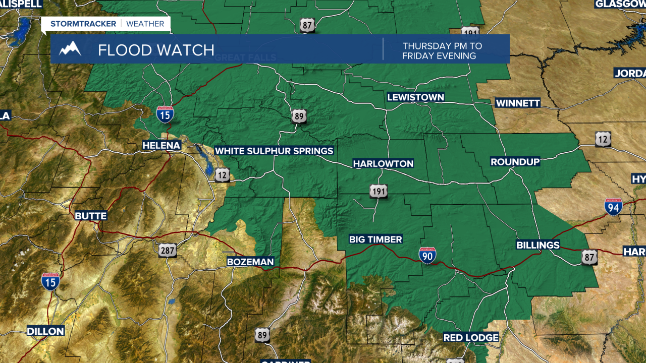
A weather system will move in from the SE Thursday into Friday and bring more rainfall with some locally heavy rain possible and again slower moving thunderstorms could produce 1” of rain per hour.

In general, most of SW Montana could see a half an inch to an inch of rain Thursday into Friday with higher amounts possible around slower moving thunderstorms.
Most area rivers, streams and creeks are running high with mountain snowmelt and with the forecast calling for moderate to heavy rain look for some minor flooding to occur by the end of the week. The area of greatest concern is across most of central Montana, but northern Gallatin, Meagher, and eastern Broadwater counties are currently under a FLOOD WATCH Thursday afternoon through Friday evening.