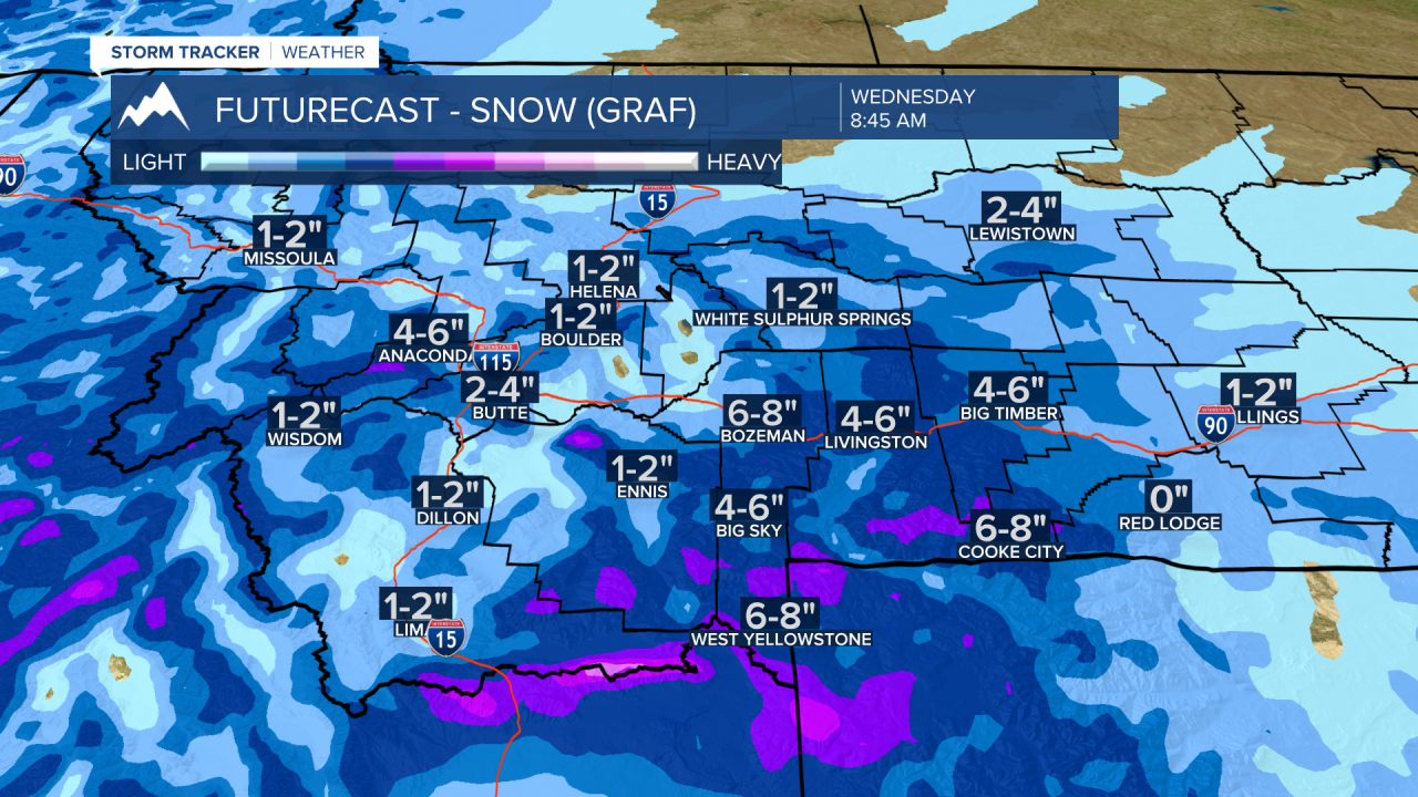
BOZEMAN – Get ready for a significant blast of winter like weather across the entire region Monday night through Wednesday night.
Snow and blowing snow are producing hazardous travel conditions for Monida Pass over to the West Yellowstone area and across Eastern Idaho. This area will continue to see snow and blowing snow conditions tonight through Wednesday morning.
A cold front will be the focal point of snow and wind to roll over western Montana Tuesday morning and push into eastern Montana by Wednesday morning. This front will bring increasing snow and wind to Butte late Tuesday morning into Tuesday afternoon. Bozeman look for rain ahead of the front Tuesday afternoon and changing over to all snow after sunset Tuesday. This could create extremely icy road conditions on Tuesday night and for Wednesday morning commutes.
Winter weather highlights from the National Weather Service:
WINTER STORM WARNING issued for Beaverhead, Madison, Gallatin counties and across eastern Idaho now through 5 am Wednesday above 6,500’.
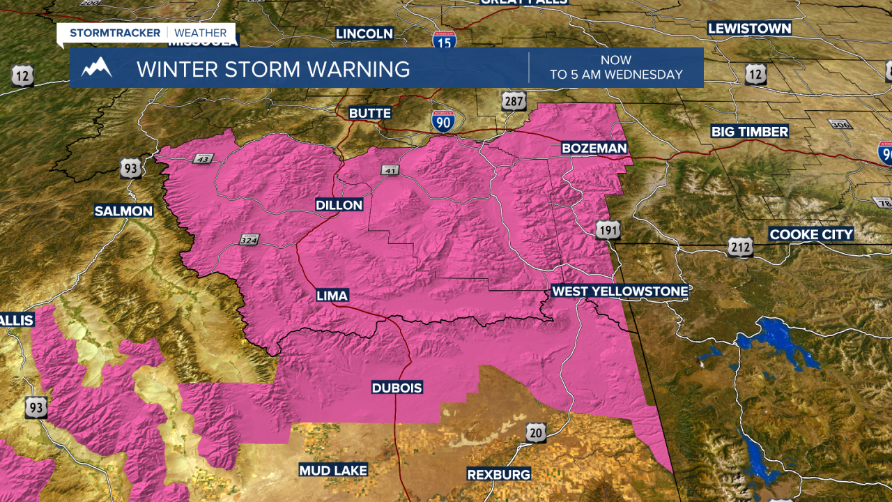
Snow accumulations 4”-12” are possible with up to 20” in some areas. Strong surface wind gusts will produce areas of blowing snow and reduced visibility.
_______________________________________________________________________________________________________________________________________________________________________________
Winter Weather Advisory issued now through 5 am Wednesday for Beaverhead, Madison, Gallatin counties below 6,500’.
Valley snow accumulations will vary from 1”-6” but there could be over 6” for several lower elevations like Bozeman.
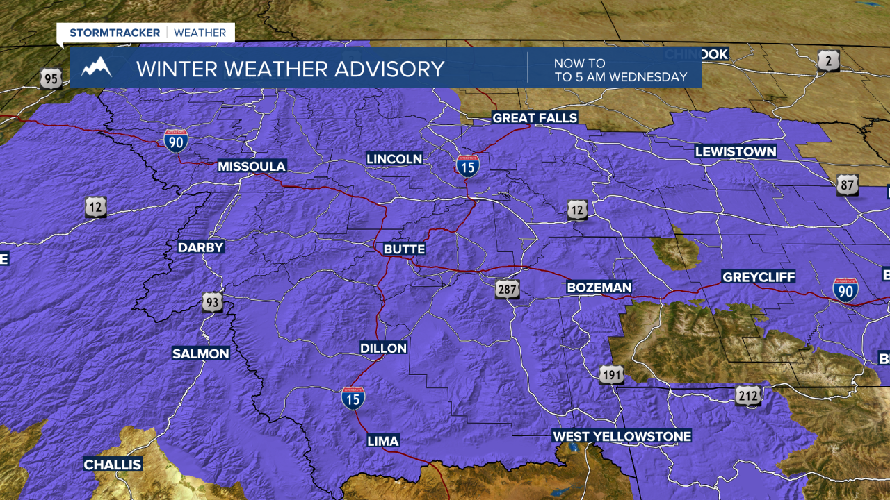
Winter Weather Advisory has been issued for the Butte-Blackfoot region from 5 pm Monday through 5 pm Tuesday.
Snow accumulations of 1”-5” or more is possible and this will impact travel conditions at all levels.
__________________________________________________________________________________________________________________________________________

is up for the Livingston area through 6 pm Tuesday with possible peak gusts up to 60 mph. Snow will develop in the Livingston area by Tuesday evening and 1”-4” is possible with considerable blowing snow through Wednesday evening.
______________________________________________________________________________________________________________________________________
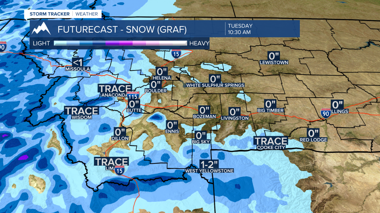
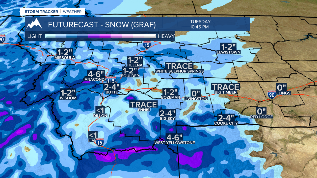
Timing out the storm and possible snow accumulations Tuesday morning into Tuesday evening and by Wednesday morning:
Graphic below by 10:30 am Tuesday
Graphic below by 10:45 pm Tuesday.
Graphic below by 8:45 am Wednesday.
