


BOZEMAN – A strong Polar Jet Stream and a very strong Pacific cold front will bring nasty travel weather conditions to the entire region through Tuesday evening.
Two weather elements when combined will produce wintry travel conditions for all area mountain passes with accumulating snow and powerful wind gusts, blowing snow, icy roads and slow-go travel.
The National Weather Service has issued a HIGH WIND WARNING for almost the entire state through Tuesday afternoon or evening.
Sustained wind 20 to 30 mph along with peak gusts between 50 to 75+ mph is possible. In high wind prone areas will likely see the strongest peak gusts. Property wind damage is also possible, along with power outages.

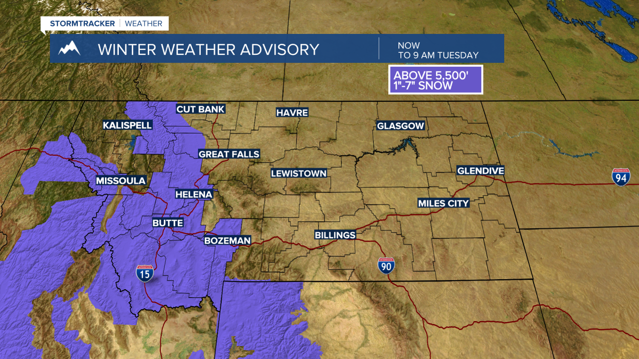
The National Weather Service has issued a WINTER WEATHER ADVISORY for most of Western and all of SW Montana through Tuesday morning.
Snow accumulations will be highly varied between 1” to 7” inches above 5,500’. All mountain passes locally will see heavy wet snow, slushy road conditions and possibly turning icy by early Tuesday morning.

Again, the combination of power surface wind gusts and increasing snow will produce hazardous travel conditions for SW Montana through Tuesday afternoon.
Temperatures will drop significantly behind the front Tuesday but begin to moderate on Wednesday and shooting well above normal by Friday.
The next storm system is coming Sunday into Monday and more cool, wet, and windy conditions are likely and hopefully producing a boost to our mountain snowpack.
