


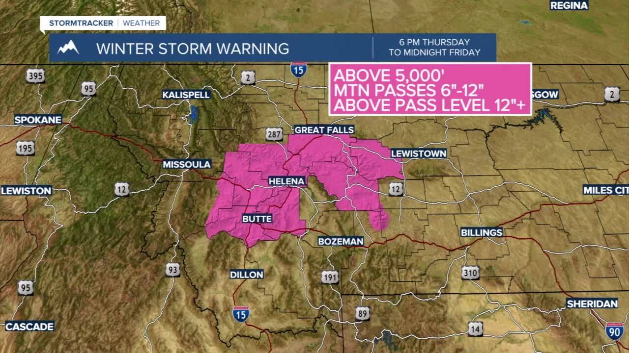
Winter Storm Warning: Issued for the Butte/Blackfoot region from 6 PM Thursday through 9 AM Friday. Total snow accumulations of 8”-14” for high mountain terrain with 2”-6” possible in valleys. Expect slushy and wet snowfall on area roadways with slick conditions expected on Homestake Pass.
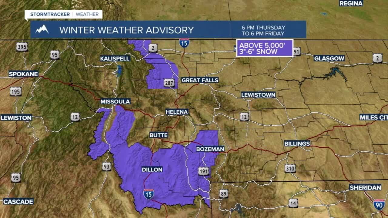
Winter Weather Advisory: Issued for Gallatin, Madison, & Beaverhead counties above 6000’ from 6 PM Thursday through 6 PM Friday. Total snow accumulations between 3”-6” for the mountains and up to 2” for Valleys.
Today's Forecast: Rain will develop in the area for the afternoon and will pick up in intensity through the late afternoon and evening. Daytime highs will stay in the low and middle 50s and cool slightly through the afternoon as rain and mountain snow begin to develop. Expect snow to develop quickly after sunset in valleys with slick and slushy conditions in place for your Friday morning commute.

BOZEMAN: High: 54; Low: 32. Look for light rain showers to develop late in the afternoon and early evening. Expect heavier rain showers through the late evening with a transition from rain to snow. Ground temperatures will be above freezing before the snow starts, so accumulation will initially be slow but as heavier bands move through the area you should expect accumulations to pick up quickly near midnight.
BUTTE: High: 51; Low: 30. Light rain showers are likely for the early afternoon with a quick switchover to snow through the evening. Accumulations could approach 1”-3” with heavier snow expected in the foothills and mountains in the region.
DILLON: High: 52; Low: 33. Expect a few spotty rain showers to develop during the early afternoon with a mix of rain and snow overnight. Accumulations are expected to be up to 1”-2” of slushy and wet snow.
WEST YELLOWSTONE: High: 50; Low: 27. Pockets of rain are expected late this afternoon with a quick changeover to snow by the early evening. Accumulations by Friday morning will likely be in the 2”-5” range.
