


BOZEMAN – The last couple of weeks have been mostly dry and with increasing temperatures we are seeing incredibly thick wildfire smoke over SW Montana Sunday and Monday from fires as far away as northern California. Fires in Oregon, Idaho and western Montana are also contributing to the thick smoke over the last couple of days.

As of 1 pm Monday afternoon air quality ratings were “UNHEALTHY” for Butte and Bozeman but “Moderate” in Dillon and West Yellowstone. Forecast models have a cold front over northern Montana and pushing south. This will likely push the thick smoke over Butte to Bozeman down toward Dillon and West Yellowstone by sunset Monday.

This front will also produce increasing surface wind gusts Monday afternoon through early evening. The combination of gusty surface winds, low humidity and above normal temperatures has a “RED FLAG WARNING” up for most of Montana through 9 pm Monday. Please be extremely careful will all outdoor activities to avoid new fire starts.

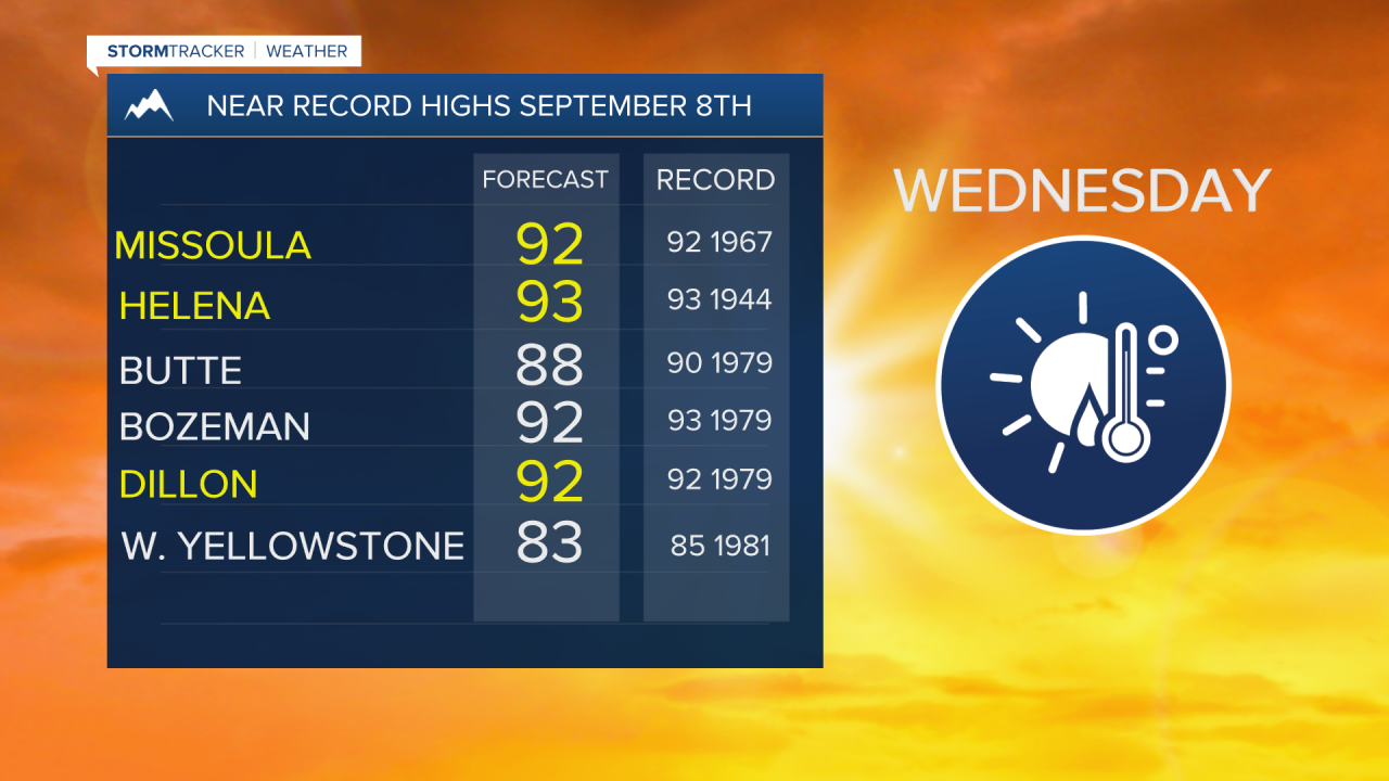
The next topic to cover is another heatwave. Temperatures are above normal Sunday and Monday and will reach their peak by Wednesday. Forecast highs in the mid 80s to mid 90s over western and southwestern Montana will be very close to record high levels Wednesday.
The forecast is also mostly dry for the next 7 to 10 days with the slight chance for a few isolated afternoon thunderstorms by Saturday and Sunday.
