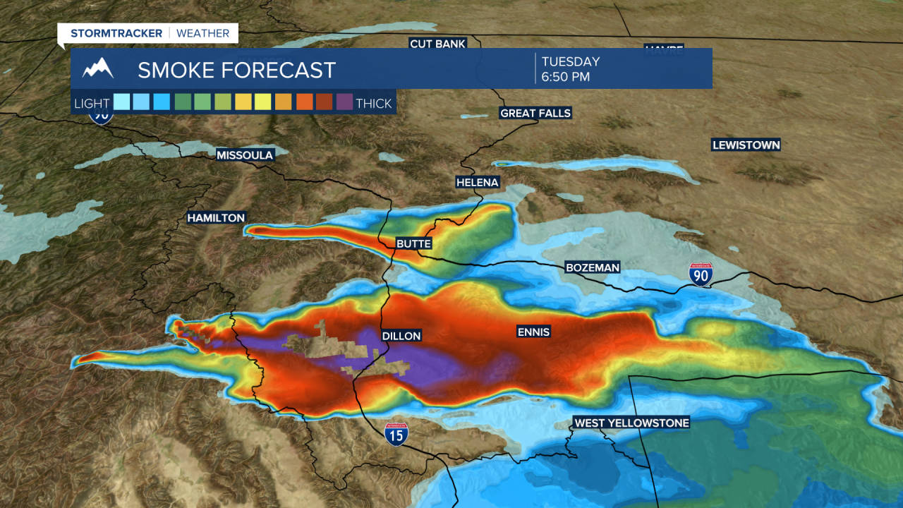
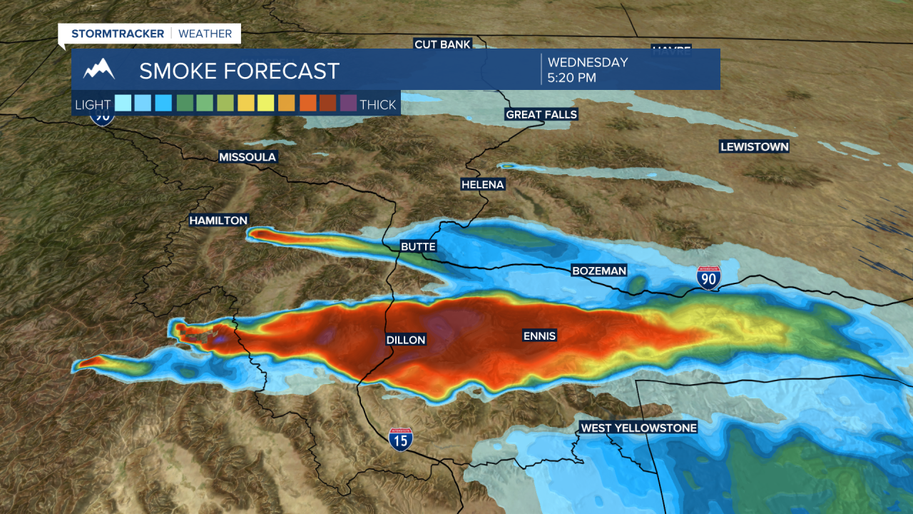
BOZEMAN – The biggest hazard for the rest of this week will be periods of thick wildfire smoke and worsening air quality conditions.
The Moose Fire near Salmon, ID grew significantly over the last 24 hours. Monday morning, the fire was estimated to be around 1,000 acres. Tuesday morning's report put the fire size at over 12,000 acres. That extreme growth was possible with the high wind event on Monday afternoon. The good news is we do not expect that pattern to return in the short-term forecast.

Latest forecast models show wildfire smoke will be thick at times, especially in the late afternoon to early evening hours from Dillon to Ennis southward. At times that Moose Fire could send surges of smoke through Butte to Bozeman if the steering winds shift out of the SW this week.


There is also a small wildfire burning in the Bitterroot Range and that fire could keep Butte on the hazy side if it continues to stay small in size. If this fire blows up there could be significant wildfire smoke from Butte to Bozeman.
The overall weather pattern is hot and dry for SW Montana for the rest of the week with High-pressure dominating the local weather pattern. Forecast highs will remain slightly above normal in the upper 80s to mid 90s.
Temperatures could be cooler again by the weekend.


