


Today's Forecast:
Much cooler start to the week with several Winter Weather Advisories and Winter Storm Warnings across western and southwestern Montana through Tuesday. Today, valleys should expect rain showers and/or rain/snow mix showers through the morning and evening with mainly rain showers during the middle of the day. Areas above 6000’ could pick up some light snow accumulation with highs in the 40s and low 50s.
BOZEMAN: High: 51; Low: 37. Scattered showers during the day with pockets of heavy rain possible. Snow may mix in before Tuesday morning though accumulations are expected to be minimal.
BUTTE: High: 45; Low: 34. Scattered showers with a rain/snow mix likely. Rain showers could be heavy at times with snow accumulations expected to be less than 1”.
DILLON: High: 49; Low: 34. Cooler with rain showers likely through the day. Overnight lows will drop quickly tonight and could bring a rain/snow mix by Tuesday morning.
WEST YELLOWSTONE: High: 50; Low: 30. Chilly showers with daytime highs in the 50s. Lows will fall quickly to the low 30s overnight. Snow showers are possible but not expected to bring much accumulation except in high elevation areas.
WINTER WEATHER FOR JUNE IN SW MONTANA
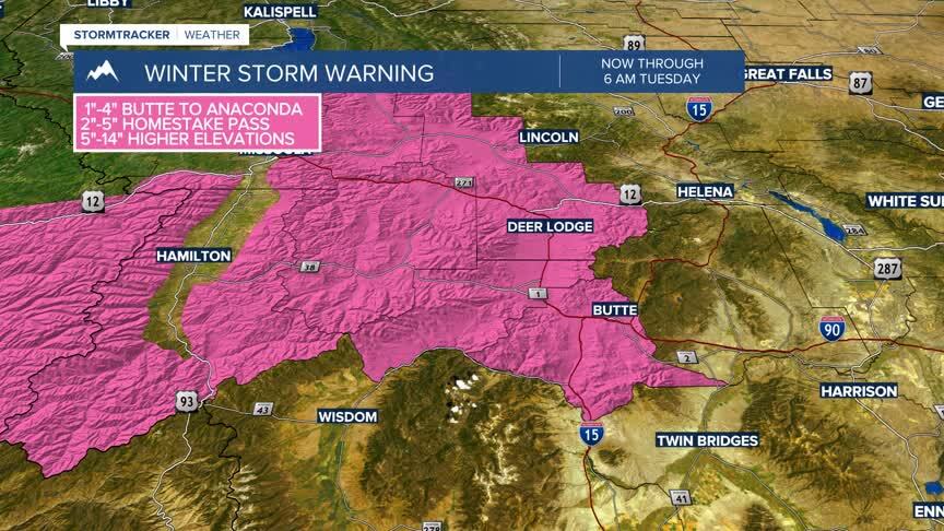
The Winter Storm Warnings in the Butte/Blackfoot region could bring between 1”-4” for Butte to Deer Lodge and back toward Georgetown Lake. We could see between 2”-5” of slushy wet snow for Homestake Pass by Tuesday morning with higher elevations possibly seeing as much as 14” of fresh wet snow.
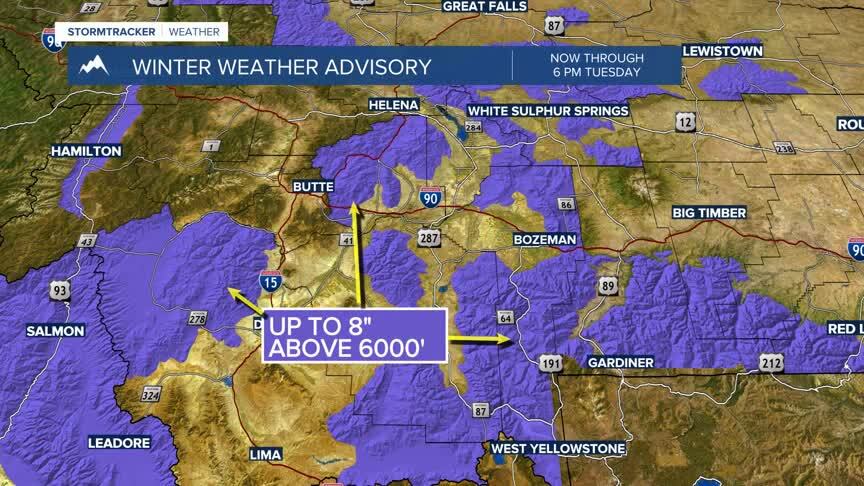
Winter Weather Advisories across the region could pick up between 1”-8” of wet snow above 6000’. Slushy and wet backcountry conditions are expected and could cause significant travel concerns at high elevations.
Monday night and Tuesday night could bring some low temperatures to near freezing. Care for small or tender plants is advised through Tuesday morning.
